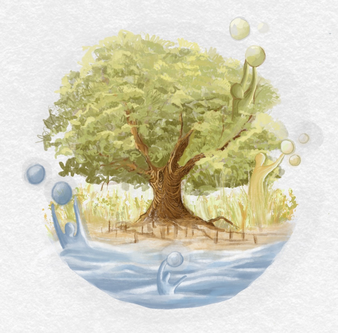
Bhima River Valley Transects: tracing how water distress and community adaptation connect, from the river to the household.
THE PROBLEM
The Bhima rises in the Sahyadris near Bhimashankar and flows from the rain-fed Western Ghats through Pune and Pandharpur into the dry, semi-arid Solapur region. It then leaves Maharashtra for Karnataka and joins the Krishna. Along this one river, distress takes opposite forms: flooding and urban pressure in some stretches, drought that can last for years in others.
That distress is felt in households, but it is produced by overlapping systems: rainfall and hydrology, dams and supply schemes, land use, industry, roads and settlement growth, and public policy. Because these links are rarely visible, people often attribute distress to the weather or to distant institutions, while planners rarely see how households actually cope, or where households sit outside the reach of infrastructure and services.
Two short examples show the pattern. Where wells and handpumps have run dry, frequent diarrhoea among children is treated as a health problem, while newly built sewage tanks sit close to the water source and contaminate groundwater. Residents blame changing weather. Where a river floods at a bend, the nearest household is damp for months and the family nails plastic laminates over the mud floor. The upstream causes (weak warnings, sudden reservoir releases) and the cheap, available fix are both part of the same chain. [Replace or confirm with your field-verified cases.]
THE APPROACH
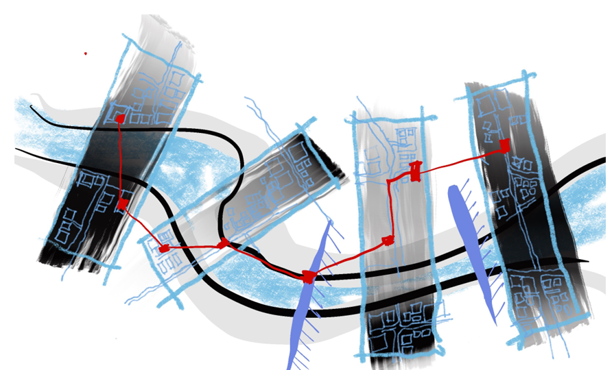
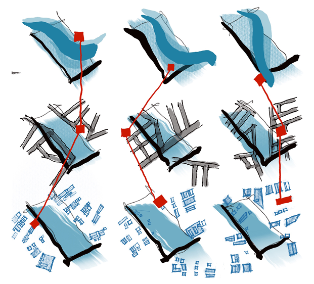
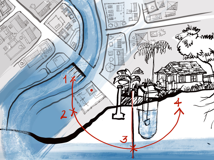
The project uses the transect: a visual technique that draws a swath through a landscape, creating a sectional sample of land. Several transects are cut at key points along the Bhima, each documenting the same six parameters, so the results can be compared across very different conditions:
- River flows (summer and monsoon)
- Water infrastructure
- Road infrastructure
- Settlements and farms
- Industries and businesses
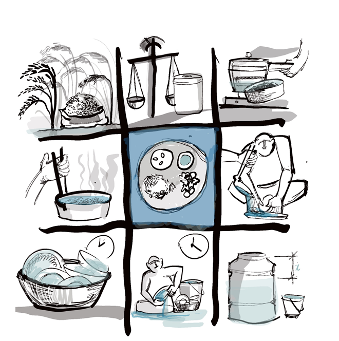
- Households, as selected case studies within each transect
The household is the unit of analysis because every system converges there. From the household upward, and from the river downward, the project traces the causal loops that lead to distress and the coping strategies that households have designed themselves, and maps both against what falls inside and outside the reach of large infrastructure and policy services.
OBJECTIVES
- Identify the diversity of water distress within the Bhima River Valley, and the crucial transects within it.
- Establish the parameters of the transects and a framework for documentation.
- Understand the tangibility and nuances of water distress at the smallest unit, the household.
- Trace the causal loops leading to distress and to coping, within the established parameters, and identify what is in the system and what is out of the reach of infrastructure and policy services.
- Present the transects as a pattern, a unified overview that shows gaps within overlapping policy and infrastructure systems and the potential for connecting surpluses to gaps.
- Create an archive of resilience strategies that can be replicated and scaled, and connect self-adapted strategies to available infrastructure and policy services, so that top-down and bottom-up services run together.
METHOD AND TIMELINE
Phase I: Transects (2 months, January to March). Literature study of the valley, transect selection, GIS mapping of flows, sediment, geomorphology and the other parameters, and a peer-reviewed context synopsis.
Phase II: The household unit (6 months, April to September). Household selection, ethnography and hydrological review, a photographic pilot, design of a documentation matrix, and documentation of households. The season is chosen to see the full spectrum from rain-fed to drought-prone conditions.
Phase III: Causal relationships (2 months). Intra- and inter-transect analysis, causal loop mapping, service and policy coverage mapping, and gap analysis, validated with households and stakeholders.
Phase IV: Patterns (up to 4 months). Findings report, an online and offline overview, the archive of resilience strategies, dialogue with service providers, and annexures for monitoring.
WHAT IT PRODUCES
Transect atlas: Mapped transects with six consistent parameters and a context synopsis.
Household documentation matrix: A framework recording daily activities, systems, water distress and coping, applied across households.
Causal loop and gap maps: Pathways to distress and to coping, with households outside service reach identified.
Archive of resilience strategies: Self-designed strategies with materials, cost, time and procurement, and conditions for replication.
Public overview: An interactive website linking region, district, tehsil and village data to household evidence, and a printed kit (booklets, maps, mobile exhibitions) in regional languages, free to participating households.
Planning decisions about water are usually made at the scale of a scheme, a district or a basin, and the household appears only as a beneficiary count. This work reverses the direction of evidence. It shows planners and communities the same picture: where services reach, where they do not, and what households do in the gap. That picture can support three uses:
Communities can replace undefined explanations with actionable ones, and reflect and re-strategise using strategies already working elsewhere in the valley.
Service providers and planners can locate exact gaps and overlaps between systems and decide where to connect surpluses to deficits.
Funders and implementing organizations can target precise, low-cost interventions and monitor their effect at household level.
This proposal builds on field studies carried out in the valley, attached below as supporting evidence. [List and link each field study: title, location, year, and what it contributes.] [Optional: link to the related paper on the Ujjani project in Solapur and its adaptable weir-and-lift model.]
The study assumes that water distress is a spectrum linked to micro-climate, micro-economy, history and land use, that it depends partly on a household’s position relative to the river, and that people improve their situation with the resources, skills and knowledge available to them. It maps the main Bhima river flow and the cross-sections of selected transects; tributaries appear only where a transect crosses them. Transects are a comparative, case-based design, not a statistical sample of the whole valley. Work stays within Maharashtra to keep language, culture and governance comparable, and could extend into Karnataka, to the confluence with the Krishna, with further funding. All participation rests on informed, enthusiastic consent.